Weet u zeker dat u deze actie wilt uitvoeren?
Diesel
€ 1,69
GTL Fuel & HVO100
€ 1,99
-
- Filters
- Bilgepompen
-
Anodes
- Fixing Bolts
- Anode For Airconditioning
- Areator Anode
- Brush Replacement
- Saildrive Anodes
- Screw Kit
- Zinc Spray
- Earthing Plate
- Shaft Grounding
- Bowthrust Anodes
- Engine Anodes Kits
- Trim Tab Anodes
- Divers Anodes
- Boiler Anodes
- Water Pumps Anodes
- Inboard Engine Pencils
- Engine Anodes
- Long Bar Anodes
- Suspended Anodes
- Disc Anodes No Holes
- Rod Anodes
- Shaft Anodes Collar Type
- Shaft Anodes HD Steel Insert
- Shaft Anodes Egg Type
- Propellor Anodes
- Weld On Anodes Alu Strip
- Weld On Anodes Ingot Type
- Weld On Anodes
- Crab Trap Anodes
- Bolt On Anodes
- Aluminiumanodes
- Magnesiumanodes
- Zinkanodes
- Pvc & Rubber
- Slangen & Fitwerk
- Ankeren
- Verwarming
- Brandstof
-
Motor & Manoeuvreersystemen
- Ventilatie
- Hydraulische Besturing
- Helmstokbesturing
- Stuursystemen
- Outboard & Toebehoren
- Uitlaatsystemen
- Schroeven & Assen
- Schroeven Vetus
- Motoronderhoud
- Afstandbediening
- Geluidsisolatie
- Elektrische Aandrijving
- Motoren
- Motoronderdelen
- Motormanagement
- Boegschroeven
- Boegschroeftoebehoren
- Motoronderdelen Per Motor
- Stroom Motor & Techniek
- Outlet
-
Winkelmand
Je winkelwagen is leeg.
Imray
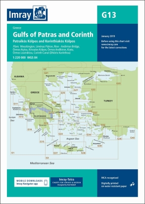
G13 Gulfs of Patras and Corinth
€ 35,50
Op voorraad in onze winkel
- Binnen 1-3 werkdagen in huis
- Wereldwijde verzending
- Veilig betalen met iDeal, Bancontact of Bankoverschrijving
Productomschrijving
G13 Gulfs of Patras and Corinth
Patraïkós Kólpos and Korinthiakós Kólpos
De G zeekaarten van Imray zijn overzichtskaarten en detailkaarten van Griekenland, Turkije en Kreta:
Op de cover / afbeedling van de betreffende kaart vindt u de editiedatum.
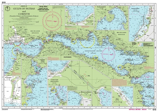
Plans included:
Mesolóngion (1:40 000)
Liménas Pátron (1:12 500)
Ríon - Andírrion Bridge (1:30 000)
Órmos Aiyíou (1:15 000)
Krissaíos Kólpos (1:50 000)
Órmos Andíkiron (1:50 000)
Kiato (1:10 000)
Órmos Loutrákiou (1:20 000)
Corinth Canal (Dhiórix Korínthou) (1:25 000)
For this 2016 edition the latest depth surveys and firing practice areas are included. Completed harbour works at Pátras, Kiato and Loutráki are shown.
Deze zeekaarten zijn gevouwen tot A4 formaat en de totale afmeting is 787x1118mm.
Tot er een nieuwe editie wordt uitgegeven kunt u hier correcties downloaden.
Specificaties
| Artikelnummer | VROL16G13 |
| Model | 16G13 |
Wilt u advies of heeft u een vraag?
We doen ons best u zo snel mogelijk te antwoorden. Weet u al een artikelnummer of heeft u een foto? We zijn voor spoedvragen ook bereikbaar op ons WhatsAppBusiness account. Whatsapp ons!


